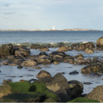
The Boston Harbor Habitat Atlas aims to enhance the public’s understanding of and connection to the coastal and marine ecosystems found in the metro Boston area, which includes Boston Harbor and the Rumney Marsh. It is designed as a living resource for individuals and families, educators and students, watershed and community groups, resource managers, researchers, and citizen scientists.
The Atlas was originally conceived by the Massachusetts Bays National Estuary Program in 2011 as a decision-support tool, and was developed in collaboration with the Urban Harbors Institute, Massachusetts Office of Coastal Zone Management, and Neponset River Watershed Association through funding from the Massachusetts Environmental Trust. Currently, the Atlas is being expanded and updated with the goal of it having broad public and educational value.
